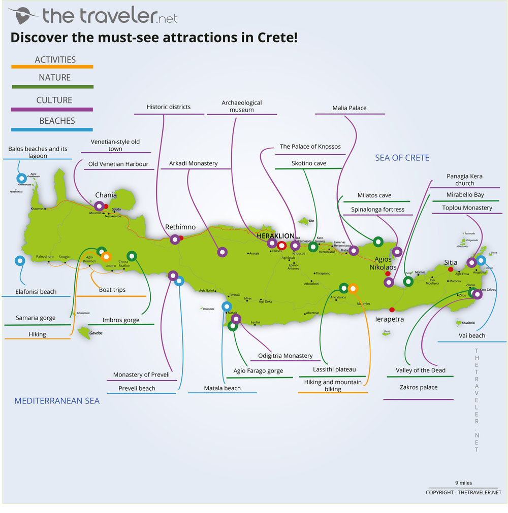
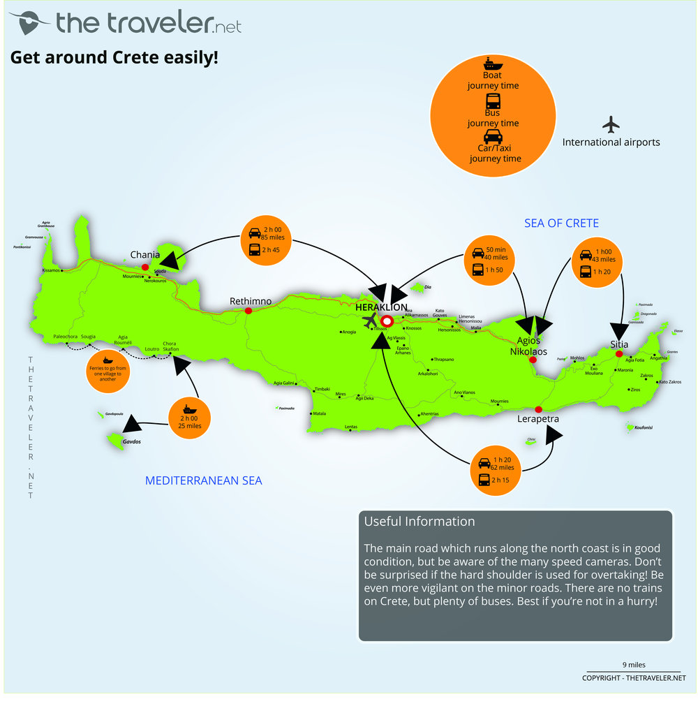
Our tourist maps

Crete is an excellent destination if you want a holiday that combines culture and the beach. It is also a destination for outdoor activities such as mountain-biking, cave diving and canyoning. To help you plan and prepare for your trip, we have put together a range of tourist maps. First is the guide to the regions of Crete. With our map of the essential Crete, you will discover the island’s main places of interest, so you’re sure not to miss anything. Our journey map allows you to plan your tour of the island, showing times and distances between the major towns. And don’t forget our map of Crete's beaches to help you find the most beautiful beaches on the island. Now you have everything you need for a trouble free stay on the peaceful, charming island of Crete. From the palace at Knossos to the Samaria Gorge and the old Venetian ports, Crete has a range of remarkable places to visit. Check out our maps to make the most of your stay. You now have all the elements to plan a hassle free stay on the charming island of Crete. From the Knossos Palace, to the old Venetian port of Chania and the Samaria Gorge, Crete offers a range of remarkable places to discover. Take a look at all our maps to plan your trip. Discover our maps to plan your trip in the best possible way.
Region map
Crete is the largest island in Greece and full of natural and cultural treasures: ancient ruins, idyllic beaches, beautiful countryside and impressive mountains. Eastern Crete is the quieter and more arid part of the island. The Lassithi Plateau’s fields, orchards and windmills is spectacular countryside to discover. Around Agios Nikolaos are pretty bays and the magnificent Spinalonga peninsula where you can enjoy long lazy days. In the north, the Heraklion area is very busy with its famous Temple of Knossos and archaeological museum. Opt for the south of this region if you want to the calm of its vineyards and traditional little villages. The fortress and minarets dominate the bay of Rethymnon, a pretty and historic town. Picturesque villages can be found on the Messara Plain, a fertile area to the south. Western Crete is the greener and more mountainous part of the island. There are beautiful beaches and the Balos Lagoon in the north-west. Chania has retained its historic charm and is one of the most attractive towns on the island. At the island’s centre are the Samaria Gorge and the majestic White Mountains which rise to 2,450 metres. Both are essential for keen hikers.
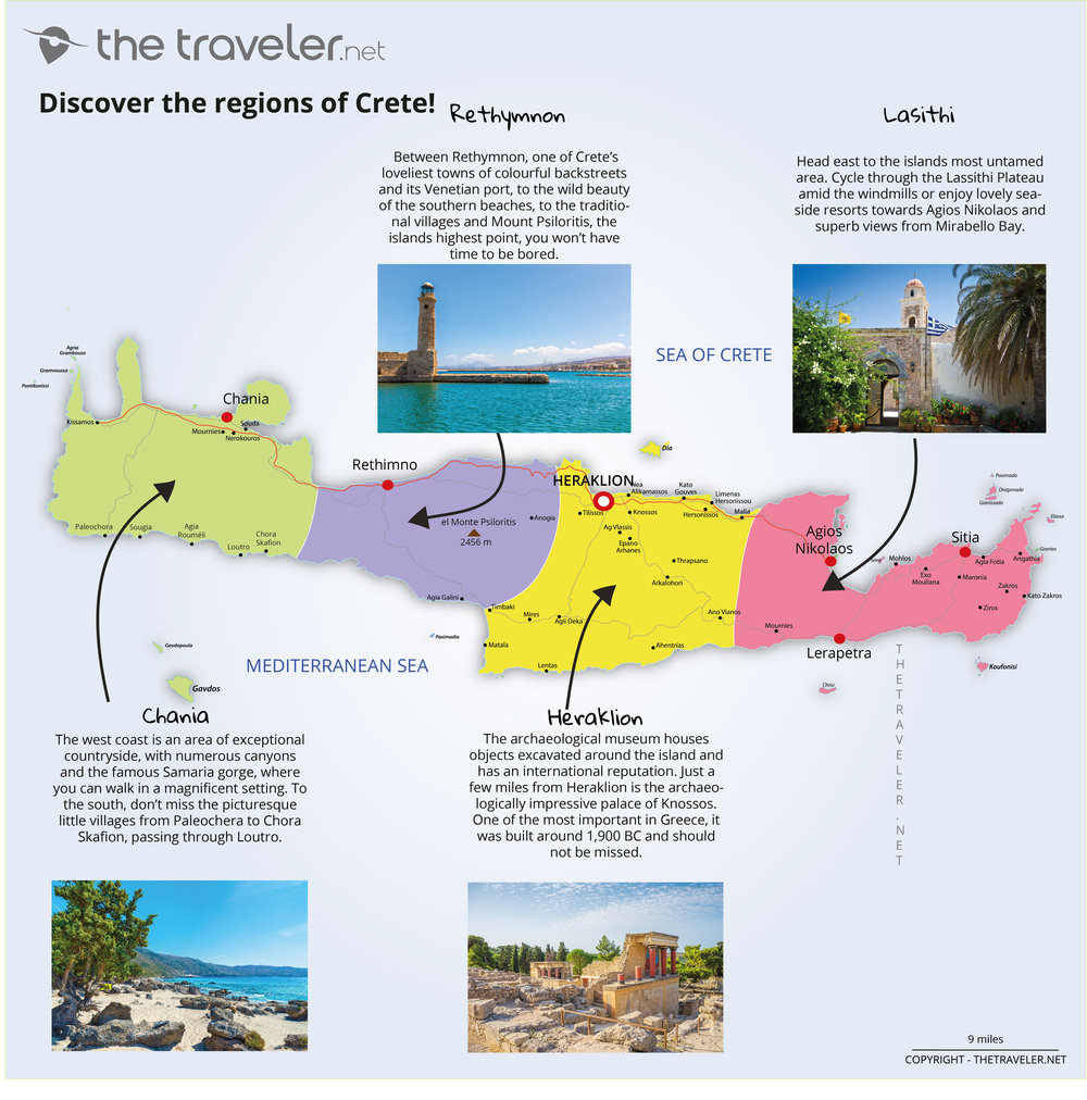
Overview of 4 tourist regions
Chania
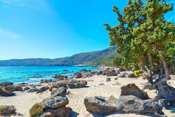
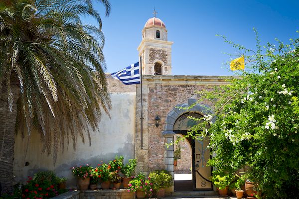
The west coast is an area of exceptional countryside, with numerous canyons and the famous Samaria gorge, where you can walk in a magnificent setting. To the south, don’t miss the picturesque little villages from Paleochera to Chora Skafion, passing through Loutro. In places, the mountains plunge sharply into the sea, making some of these villages accessible only by boat. As for beaches, you will find the most beautiful on the island of Elafonissi, a tropical paradise. Chania itself is said to be one of the most beautiful towns on the island. It has a rich cultural history and the town is full of resplendent monuments in the Venetian and Ottoman styles. Take the time to wander through its backstreets where you can see traditional craft stalls and stately villas. Stroll through the old Venetian port and visit the lighthouse.
Heraklion
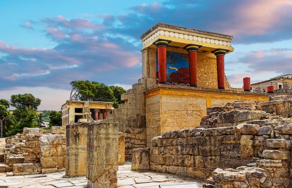
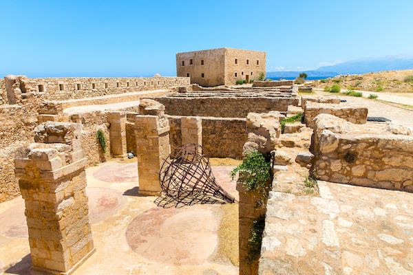
Not as picturesque as Chania or Rethymnon, Crete’s largest town and its hotel complexes which line the coast also has less of interest to the tourist. The archaeological museum houses objects excavated around the island and has an international reputation. Just a few miles from Heraklion is the archaeologically impressive palace of Knossos. One of the most important in Greece, it was built around 1,900 BC and should not be missed. If you’re looking for a little peace and quiet, head further south through the Massara Plane along roads lined with olive groves, to Agio Farago. And don’t miss the Palace of Phaistos which has an exceptional view of Mount Psiloritis, the islands highest point.
Lassithi
Head east to the islands most untamed area. Are you the sporting type? You can walk or cycle through the Lassithi Plateau amid the windmills and the magnificent views of Mount Dikti and Mount Selena. Or is it beaches you’re looking for? There are lovely seaside resorts towards Agios Nikolaos and superb views from Mirabello Bay. Want to go exploring? There’s the Toplou Monastery, one of the oldest and most imposing in Greece, and the beautiful paintings in Panagia Kera church.
Rethymnon
This is a region that demands time to admire it. Between Rethymnon, one of Crete’s loveliest towns of colourful backstreets and its Venetian port, to the wild beauty of the southern beaches, to the traditional villages and Mount Psiloritis, the islands highest point, you won’t have time to be bored. Visiting the monastery of Moni Arkadi is a must. Founded in the 13 th century, a few monks still go about their business there.
Attractions maps
Crete is an island filled with places to visit. From magnificent historic villages to glorious archaeological sites and the breathtaking countryside of mountains and sea. Among the essential places to visit are the Temple of Knossos, the most visited archaeological site on the island, the monasteries of Arkadi, Toplou and Preveli, and the wonderful towns of Chania and Rethymnon with their steeples and minarets. Do you want idyllic beaches? Crete has them the length of its coast. Elafanossi with its swathe of fine sand shouldn’t be missed and nor should the Balos Lagoon with its turquoise water. Discover Crete's most beautiful beaches with our map. Crete is a paradise for the sporting, especially hikers who can enjoy the many trails around the island. The Samaria Gorge, known throughout Europe, promises an unforgettable and spectacular 10 mile walk. Its narrowest point is less than 3 metres wide and is known as the “Iron Gate.” Aradena, Karanou and Irini gorges are smaller but lesser known and wilder. We have created an activity map for what to do in Crete .
Routes and distances maps
Welcome to Crete, largest island of the Greek archipelago. Its elongated shape is about 160 miles wide but less than 35 miles from north to south. So distances from one place to another are reasonably short. Getting around by car: It takes around 3 and a half hours to get from Chania (west coast) to Sitia (east coast) using the New Road, the islands main road. If you are hiring a car in Crete , you may be a little surprised by Cretan driving which is not always respectful of the rules of the road. It’s common to use the hard shoulder for overtaking, white lines are ignored, corners are cut and cars are parked anywhere at all! It’s best you know in advance. Even if Cretan driving is undisciplined, you should respect the rules of the road, especially the speed limit and wearing a seatbelt. Driving offences can be heavily penalised by the local police who have increased the number of patrols in order to reduce the frequency of accidents. Be careful of your alcohol consumption. There is a tendency to drink a little more than usual on holiday, but any more than 0.5 per litre (bac) and you’re over the limit. The roads are generally well maintained. In the less touristic areas, especially in the south, its not unusual to find roads that are deteriorating. That’s the case, for example, when visiting the magnificent Balos, where you have to drive for nearly five miles along a gravel surface. It’s the same towards Agio Farago Gorge where the gravel stretches for over two miles. It’s best to hire a vehicle which is suitable for that sort of terrain. Getting around by bus: There are no trains on Crete. The bus network run by KTEL is reasonably extensive and all the major towns are served as are the principal tourist attractions. On the other hand, it helps if your not in a hurry, as it’s not very rapid. Getting around by ferry: In the south-west, it’s possible to get from one village to another by ferry. As the mountains descend into the sea, it has not always been possible to build roads to certain places. Paleochora and Chora Skafion are two villages served by ferries.
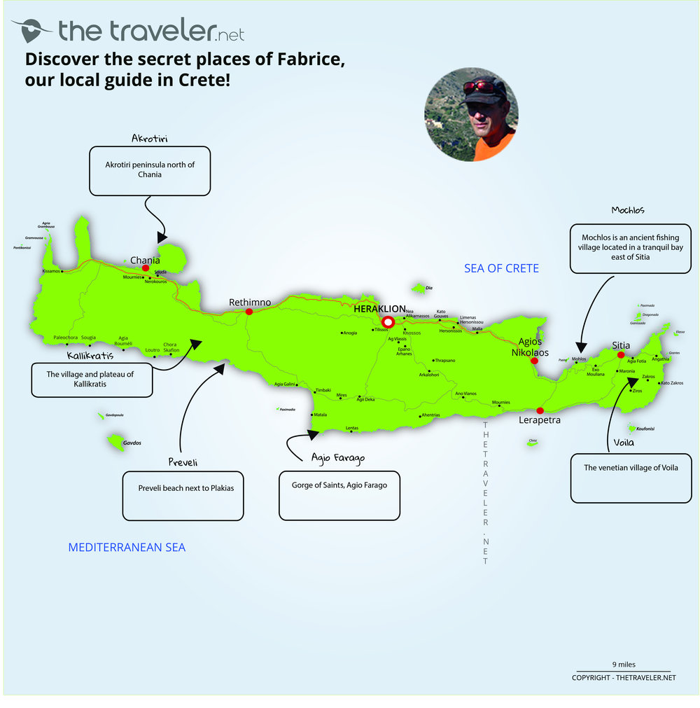
Fabrice' secret spots, our local guide from Crete